

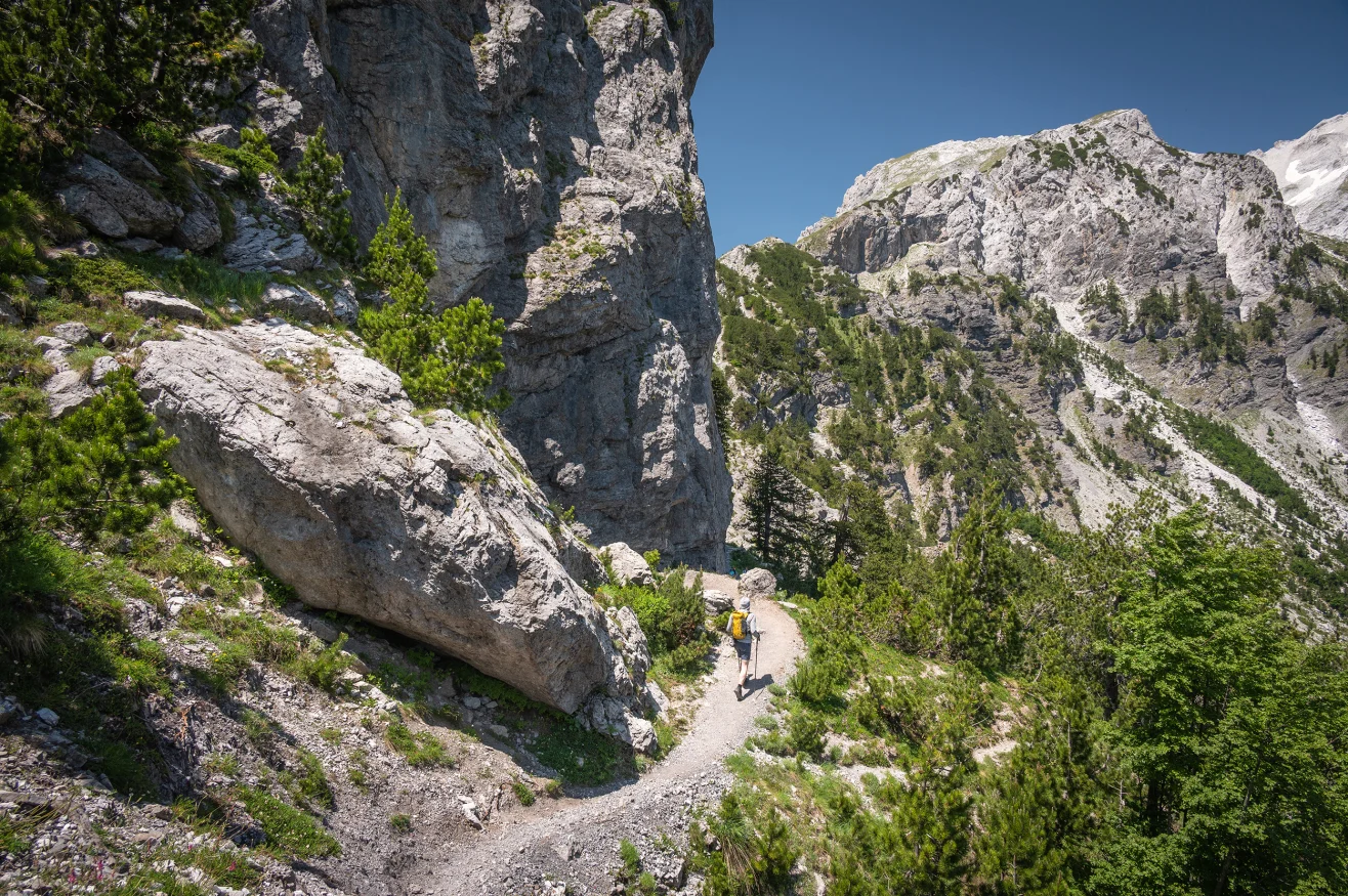
Vusanje, Montenegro — The Peaks of the Balkans trail is a 192-kilometer circular hiking route through the mountains of Montenegro, Albania and Kosovo. It follows old shepherd paths and remote mountain tracks across the Accursed Mountains, linking three countries in one demanding journey.
The route can be completed in about 10 to 12 days, depending on fitness, weather and pace. Hikers can begin in Theth in Albania, Plav in Montenegro or Peja in Kosovo. The official trail information describes the route as easy to moderate overall, but stresses that good physical condition and proper mountain equipment are necessary.
The landscape changes constantly. Alpine valleys give way to steep limestone ridges, dense forests, high meadows and clear mountain lakes. In Montenegro, the route enters the Prokletije range, where more than 20 peaks rise above 2,500 meters. The country’s tourism authority describes the area as one of Montenegro’s most challenging mountain environments. Prokletije National Park is also home to Lake Hrid, one of the most distinctive natural attractions along this section of the mountains.
Unlike heavily developed hiking destinations in the Alps, much of the Peaks of the Balkans trail remains sparsely populated. Some sections pass through uninhabited mountain terrain, where hikers may spend hours without encountering roads, large settlements or commercial facilities. That isolation is one of the route’s greatest attractions. It is also one of its main challenges.
A Wilderness Shaped by Mountains and History
The Accursed Mountains form part of the Dinaric Alps and extend across northern Albania, southwestern Kosovo and eastern Montenegro. Their difficult terrain helped preserve remote communities and traditional landscapes, while political borders kept many mountain paths isolated for decades.
The modern trail uses some of those old routes to connect communities that were once separated by political tensions. The official trail project describes the 192-kilometer circuit as a cross-border route created to support local communities and develop mountain tourism across the three countries. The scenery is impressive from almost every direction. Sharp limestone peaks rise above green valleys, while forests cover lower slopes and alpine meadows open around higher passes.
Montenegro alone has around 3,000 kilometers of mountain trails, including approximately 1,480 kilometers of arranged and marked hiking routes. Its tourism authority identifies Prokletije as one of the country’s major destinations for demanding trekking. Montenegro’s hiking and trekking routes include paths around Plav, Gusinje and Lake Hrid.
The landscape also carries visible reminders of the 20th century. Abandoned military structures and concrete bunkers can still be found in parts of the region, particularly in Albania, where decades of political isolation left a distinctive mark on the countryside.
Yet the atmosphere on the trail is far removed from that history. Hikers move through villages where traditional houses and family-run guesthouses remain part of daily life. Local hosts provide meals and accommodation, allowing visitors to experience the region beyond its scenery. That connection with local communities is an important part of the route.
The trail was developed not only as a hiking attraction but also as a way to encourage economic activity in remote mountain areas. The project brought tourism organizations, hiking clubs and local communities from Montenegro, Albania and Kosovo into a shared destination.
The result is unusual for Europe: a long-distance trail where crossing an international border can happen on foot, in the middle of a mountain landscape, without the visual separation normally associated with international travel. There is, however, an important practical difference between hiking across three countries and simply walking across a border.
Border permits are required for certain crossings along the route. Applications involve the relevant authorities in Albania, Kosovo and Montenegro, and hikers need to provide accurate information about their planned crossing dates and locations. Peaks of the Balkans border permit requirements explain the procedures travelers need to arrange before setting out.
A Different Kind of European Hiking Adventure
The physical demands of the Peaks of the Balkans trail become increasingly obvious once the route climbs away from the valleys. The trail reaches elevations of around 2,300 meters and includes repeated ascents and descents. The complete circuit consists of 10 stages, although hikers can adapt the itinerary according to their abilities and travel plans.
Technical climbing skills are not normally required. However, this is not a casual walking holiday. Steep climbs can become exhausting during warm summer afternoons. Descents can be equally demanding because loose rocks, uneven ground and narrow paths require careful footing.
The official trail guidance recommends hiking boots, waterproof clothing, a lamp, GPS equipment, a first-aid kit and a mobile phone. Because parts of the route cross uninhabited areas, hikers are also advised to travel in groups or with a local guide.
The effort is rewarded by the landscape. One of the highlights is Lake Hrid in Montenegro, located high in the Prokletije mountains. The lake sits among forests and dramatic peaks, creating a natural swimming and resting point after a demanding section of the route.
Other sections pass through broad mountain meadows where traditional livestock farming remains visible. Shepherds still use some of the same routes that now carry international hikers.
The accommodation adds another dimension to the journey.
Instead of large hotels, hikers can stay in traditional houses, small mountain lodges and guesthouses. Local families often provide homemade food, giving travelers a direct connection with the communities surrounding the trail.
The Peaks of the Balkans trail therefore combines physical effort with cultural immersion. The mountains are the main attraction, but the people living among them are part of the experience.
The route is particularly attractive for travelers who find Europe’s better-known hiking destinations too developed or crowded. There are no major resorts dominating the landscape, and commercial infrastructure remains limited in many areas.
That does not mean the trail is inaccessible.
The route is marked and signposted, and detailed stage information, maps and GPS data are available through the trail’s established hiking network. The official trail description also recommends using experienced local guides, particularly because some sections enter remote and uninhabited terrain. Peaks of the Balkans trail stages and route information provides details on the 10-stage circuit, equipment requirements and starting points.
The best hiking period depends on the section and elevation. Montenegro’s tourism guidance generally identifies summer as the preferred season for trekking in Prokletije, although snow can still appear at higher elevations.
Weather remains one of the variables hikers cannot control.
A sunny morning can turn into a difficult afternoon in the mountains, making preparation essential. Good footwear, waterproof clothing, navigation equipment and sufficient food and water are more important here than they would be on a heavily serviced European hiking route.
For travelers willing to accept those demands, the Peaks of the Balkans trail offers something increasingly difficult to find in Europe: a long-distance journey through a genuinely remote landscape, where dramatic mountains, traditional communities and complicated history remain part of the same experience.