
Kentucky Residents Report Stronger Winds as Severe Weather Patterns Intensify
Across Kentucky, residents are increasingly questioning whether the state is becoming windier. In cities such as Louisville, stronger gusts, more frequent wind advisories, and damaging storm systems have become difficult to ignore. Conversations about changing weather conditions have expanded from local neighborhoods to online forums, where many people describe an apparent rise in severe wind events over the past several years.
Meteorologists say these observations may reflect broader atmospheric changes occurring across portions of the United States. While Kentucky has always experienced seasonal storms, recent years have brought more intense weather systems capable of producing destructive straight-line winds, sudden temperature swings, and tornado outbreaks. These changes are drawing attention to the possible influence of climate warming on regional weather behavior.
The growing concern is also tied to the economic impact of severe weather. Strong windstorms have caused repeated power outages, infrastructure damage, and costly repairs throughout Kentucky communities. According to data from the National Weather Service, powerful thunderstorm systems with damaging winds are becoming increasingly significant hazards across parts of the Ohio Valley and the southeastern United States.
Scientists continue studying how rising global temperatures may be altering jet stream behavior, moisture patterns, and storm intensity. Research published by organizations such as NOAA Climate.gov suggests warmer atmospheric conditions can increase the amount of energy available for severe weather development, especially during transitional seasons like spring and early summer.
Why Kentucky Could Be Seeing More Severe Windstorms
Meteorologists explain that several atmospheric factors may contribute to stronger wind events across Kentucky. One important element is the interaction between warm, moisture-rich air from the Gulf of Mexico and colder systems moving eastward across North America. When these air masses collide, they can generate powerful thunderstorms capable of producing damaging winds over large areas.
Louisville and surrounding regions sit within a geographic zone that is particularly vulnerable to rapid weather changes. As temperatures fluctuate more dramatically, storm systems may strengthen faster and maintain higher wind speeds for longer periods. Experts also note that urban development can influence how people perceive wind intensity, especially in expanding metropolitan areas where buildings create wind tunnels and alter airflow patterns.
Climate scientists are also studying how changes in the polar jet stream may influence storm tracks across the Midwest and South. Some research indicates that shifting atmospheric circulation patterns are allowing severe weather systems to move farther east than they historically did. Information from the Environmental Protection Agency highlights that climate change can intensify certain extreme weather events, including heavy storms and severe precipitation systems.
At the same time, experts caution that weather variability naturally exists from year to year. A few particularly active storm seasons do not automatically confirm a permanent trend. Long-term climate records are necessary to determine whether Kentucky is truly becoming windier over multiple decades.
Is Tornado Alley Expanding Toward Kentucky?
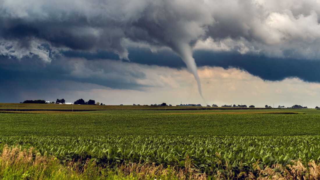
One of the most widely discussed questions among weather experts is whether Tornado Alley is gradually shifting eastward. Traditionally associated with states such as Oklahoma, Kansas, and Texas, tornado activity has increasingly affected areas farther east, including Kentucky, Tennessee, Arkansas, and parts of Mississippi.
Several studies suggest that the highest concentration of tornado outbreaks may now be occurring more frequently in portions of the Mid-South and lower Ohio Valley. Kentucky has experienced multiple destructive tornado events in recent years, fueling concerns that the state may face elevated risks in the future.
Unlike the traditional Great Plains region, Kentucky’s terrain and population density can make tornadoes especially dangerous. Many storms occur at night or during periods of heavy rainfall, reducing visibility and limiting warning response times. According to information available through the Federal Emergency Management Agency, preparedness and early warning systems remain critical as severe weather threats evolve across the country.
Meteorologists emphasize that tornado formation depends on a combination of atmospheric instability, wind shear, humidity, and temperature contrasts. As climate conditions continue changing, researchers are closely monitoring whether these ingredients are becoming more favorable in eastern states.
Climate Change and the Future of Kentucky Weather
Although scientists continue debating the exact relationship between climate change and tornado frequency, there is growing agreement that warmer global temperatures can increase the intensity of severe weather environments. Even if tornado numbers fluctuate annually, the storms that do form may carry greater destructive potential due to increased atmospheric energy and moisture availability.
Kentucky’s future weather patterns could include stronger thunderstorms, heavier rainfall, more frequent flash flooding, and damaging wind events. Insurance companies, infrastructure planners, and emergency management agencies are already adapting to the possibility of more volatile weather conditions throughout the region.
Communities across the state are also becoming more aware of the importance of weather preparedness. Improved forecasting technology, emergency alert systems, and public education campaigns are helping residents respond more quickly to dangerous storms. Still, experts warn that preparedness will become increasingly important if severe weather trends continue intensifying in the coming decades.
For many Kentucky residents, the question is no longer whether recent storms feel stronger, but whether these events represent the beginning of a long-term climate shift affecting the entire region.