A new scientific study suggests that the global threat posed by rising sea levels may be far greater than previously understood. Researchers have found that tens of millions more people could face flooding and land loss as oceans expand due to climate change, highlighting the increasing urgency of climate adaptation and mitigation efforts worldwide.
The study, published in the journal <a href=”https://www.nature.com”>Nature</a>, indicates that as many as 132 million additional people could be living in areas vulnerable to rising seas compared with earlier estimates. The updated findings suggest that previous research may have underestimated the current height of the world’s oceans, meaning that more coastal land is already closer to flooding thresholds than scientists had believed.
These revised estimates could reshape global assessments of climate vulnerability, particularly for densely populated coastal regions and low-lying island nations.
New Measurements Reveal Higher Current Ocean Levels
The study’s findings are based on updated measurements of current sea levels. Researchers discovered that many previous studies began with baseline ocean heights that were about 10 inches lower than the actual levels observed today.
This discrepancy significantly affects projections of future flooding. If sea levels rise by approximately 3 feet compared with average levels recorded between 1995 and 2014, the amount of land exposed to inundation would be substantially greater than earlier models predicted.
Scientists explain that the difference stems from the way ocean height has traditionally been calculated in climate models. Many studies rely on gravitational mapping of Earth’s surface, known as a geoid model, which simulates the shape of the ocean under stable conditions but does not fully capture dynamic forces such as tides, currents, and wind patterns.
Researchers compared hundreds of sea-level studies conducted between 2009 and 2025 and found that roughly 90% of them relied on ocean level baselines that were too low. Updated calculations using direct measurements indicate that up to 37% more land area could face flooding under similar sea-level rise scenarios.
Global climate monitoring agencies such as the <a href=”https://www.noaa.gov”>National Oceanic and Atmospheric Administration</a> regularly track sea level changes using satellite observations and coastal monitoring systems.
Coastal Regions in Asia Face the Highest Risk
The impact of the revised data is particularly significant for regions where populations live close to sea level. Southeast Asia and the Indo-Pacific region appear to face some of the largest increases in projected risk.
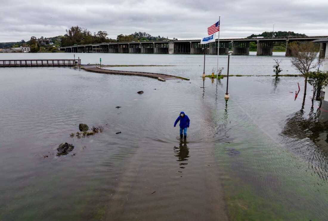
In several parts of these regions, ocean levels are already more than 3 feet higher than the baselines commonly used in global climate models. As a result, millions more people could be living in areas vulnerable to flooding, storm surges, and permanent land loss.
Globally, scientists estimate that average sea levels have already risen between 8 and 9 inches since the late 19th century. The increase is driven primarily by melting glaciers and polar ice sheets, along with thermal expansion as warming ocean water takes up more space.
Climate research organizations including the <a href=”https://climate.nasa.gov”>NASA Climate Change program</a> have documented accelerating ice loss in regions such as Greenland and Antarctica, both of which contribute significantly to rising sea levels.
In some coastal areas, the effects are intensified by land subsidence, where the ground itself is gradually sinking due to natural geological processes or groundwater extraction. This combination of rising seas and sinking land heightens flood risk for communities across many parts of the world.
Implications for Climate Policy and Coastal Planning
While the updated global projections are significant, some scientists note that the findings may not drastically change how individual coastal communities plan for sea-level rise. Local planning typically relies on more precise regional measurements rather than broad global estimates.
Urban planners and engineers often analyze detailed elevation maps, infrastructure layouts, and local tidal conditions to determine how communities should respond to future flooding risks. Adaptation strategies can include building sea walls, restoring wetlands that absorb storm surges, elevating infrastructure, or relocating vulnerable communities.
International organizations such as the <a href=”https://www.unep.org”>United Nations Environment Programme</a> have emphasized the importance of improving global climate data to support policy decisions and international climate negotiations.
For many low-lying countries and island nations, accurate estimates of sea-level risk are especially important. These countries have increasingly pushed for stronger global action on climate change, arguing that rising seas threaten both their economies and long-term habitability.
As climate scientists refine their models and incorporate improved ocean measurements, the updated findings underscore the scale of the challenge facing coastal populations. With hundreds of millions of people living near sea level worldwide, even modest increases in ocean height could have far-reaching consequences for cities, ecosystems, and global migration patterns.