Impact on North Carolina
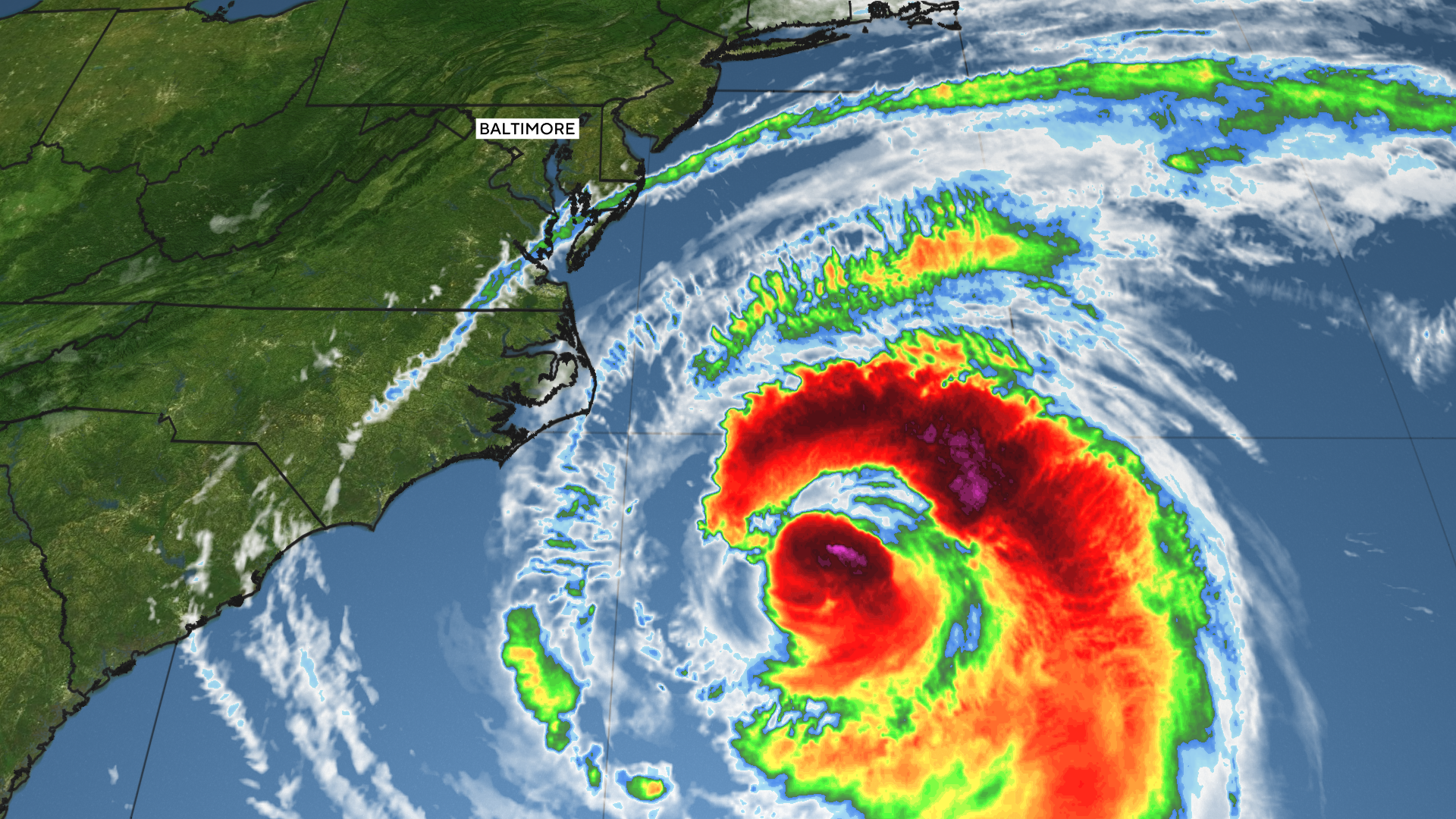
Hurricane Erin, a Category 2 storm, is moving northeast after brushing past North Carolina, where it triggered flooding, road closures, and storm surge in the Outer Banks.
According to the National Hurricane Center, Erin sustained winds of 100 mph and was located about 420 miles northeast of Cape Hatteras.
A storm surge warning remains in effect from Cape Lookout to Duck, North Carolina, posing a significant risk of coastal flooding. While tropical storm warnings were discontinued in some areas, Bermuda is now under alert.
Coastal communities affected
Thursday evening’s high tide brought additional flooding across parts of the Outer Banks, the National Weather Service reported. Highway 12, the only main road in and out of Ocracoke and Hatteras islands, was cut off by water, sand, and debris.
Authorities reported that more than 2,000 residents and visitors evacuated the area. Ferry services were halted, and waves reached beachfront properties built on stilts, eroding protective dunes.
Ongoing risks and forecast
Although Erin did not make landfall, its unusual size — with tropical-storm-force winds extending across a 600-mile-wide area — continues to create hazardous surf conditions and dangerous rip currents along much of the East Coast.
Officials have warned that flooding and rip currents will remain a threat through the weekend. Forecasts indicate that Erin is turning northeast into the western Atlantic and is expected to weaken gradually, dropping below tropical storm strength by Saturday.